0
Days to go until path-extinguishment dayOn 1 January 2031, we face the very real possibility that the general public’s right to countless routes will be lost forever.
The 2000 Countryside and Rights of Way Act introduced a guillotine of 1 January 2026 for applications to add historic paths to the definitive map. On this date, our rights to unrecorded and unapplied for routes were to be extinguished - the argument being that landowners would have the certainty of knowing where paths were.
24 years on, and with a new cut-off date of January 2031, promised funding for voluntary bodies to research and complete the definitive map before the closure has not been forthcoming.
The mitigating measures promised by the government to limit the guillotine’s effect and ensure that applications to add routes to the definitive map were processed more quickly have been neglected, if not totally ignored.
You can find further information about saving public routes on the Restoring the Record webpage, and in this guide, Taking Action.
Have a read of some of the recent successful path protection cases.
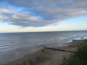
We celebrate addition of restricted byway to Norfolk’s path-map
We are delighted that our Norfolk local correspondent, Ian Witham, has succeeded in his application to upgrade a public footpath at Mundesley to a restricted byway, with rights for cyclists, horse-riders and carriage-drivers, in addition to walkers. The 60-metre path runs roughly south-west to north-east, between the C634 Cromer Road to the clifftop. The route…
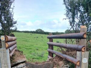
We free Cornish footpath from illegal obstruction
Through threat of legal action, we have achieved the removal of several illegal obstructions on a public footpath at St Ervan, three miles south-west of Padstow. Lucy Wilson, our local correspondent for North Cornwall, threatened to go to court for the removal of two unlawful gates on St Ervan footpath 16, south of Treglinnick Farm. …
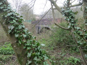
We win recorded route in East Sussex
We are celebrating the addition of a 2.3-kilometre restricted byway to the official map of public paths in East Sussex. The route was claimed, based on historical evidence, by our local correspondent for Lewes, Chris Smith. The path runs from Robin Post Lane in the north (to the west of the A27 between Hailsham and…