Support us from £3/month
We deal with almost 1000 cases a year assisting communities, groups and individuals in protecting their local spaces and paths in all parts of England and Wales. Can you help us by joining as a member?
We have launched our campaign to save England’s much-loved open spaces.
We have published an open spaces tool-kit for communities to protect their green spaces, and have called on planning authorities to respond positively to requests to save local spaces.
Our tool-kit consists of three handbooks:
How to win local green space through neighbourhood plans;
Community assets and protecting open space; and
Local green space designation.
We have written to all the English local planning authorities calling on them to be proactive in designating land as local green space (LGS) through neighbourhood plans.

Invitation to take part in neighbourhood plan for Henley and Harpsden, South Oxfordshire
Says Nicola Hodgson, our case officer: ‘The National Planning Policy Framework [NPPF] has been in place for three years, with its opportunity to designate land as LGS [paras 101-103]. Yet only a few have been designated. Moreover it has for four years been possible to list open spaces as community assets, but few have been registered. The society wants to make it easier for communities to rescue their threatened open spaces.’
Community assets
Nicola continues: ‘We want to help people to list open space as a community asset. This is an alternative way to protect land or buildings because listing is regarded as a “material consideration” in planning.
‘We are alarmed that some authorities are not abiding by the Department of Communities and Local Government’s guidance and are granting planning applications despite land being listed. This has occurred in the London Borough of Hackney where listings have been ignored.
‘It is becoming more difficult to list open spaces. The data collected by Development Control Services in 2014 from 134 local planning authorities shows that only half the open space nominations succeeded (ie 36 out of 71). This is a worrying trend which must be addressed. Our guidance will help local people to succeed.’
Local green space
Nicola explains: ‘The LGS designation was intended to mitigate the draconian Growth and Infrastructure Act 2013 which prohibits an application for registration as a village green on land that has entered the planning system. But we haven’t seen this mitigation: the law has stopped many legitimate applications for greens without giving us any LGSs in return.
‘We are concerned that the National Planning Policy Guidance gives inadequate advice on the designation of LGS. The definitions of what might constitute LGS are vague. The public is left in the air, without any clear guidance on how to proceed. There is no nationally-prescribed process and so it is left to local planning authorities to decide how to determine any submissions for LGS.
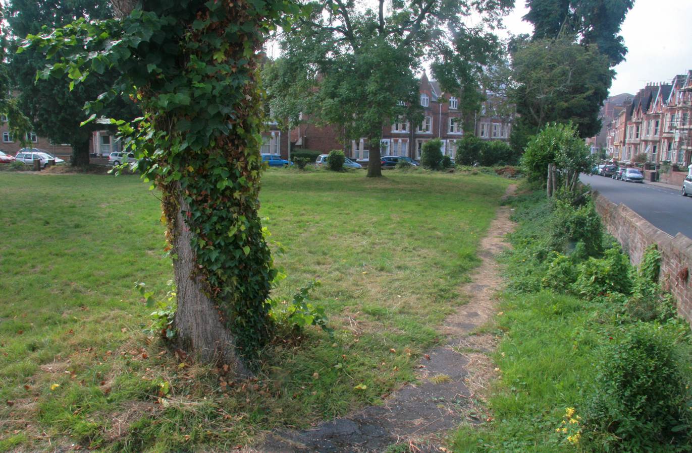
Queen’s Crescent Gardens, local green space in Exeter, Devon. Photo: Alwyn Bowen.
‘We want the authorities to be proactive in helping communities identify and designate LGS in the neighbourhood planning process, and we want them to look sympathetically at all applications for LGS,’ says Nicola.
‘Our letter urges them to do this and tells them about our guidance.’
Examples of the urgent need for clear guidance and practical help for communities
• The Thame neighbourhood plan (South Oxfordshire District, Oxfordshire) was a flagship project which won government funding, yet the community was not made aware of the opportunity to designate LGS. The result is that precious green space is now vulnerable to development.
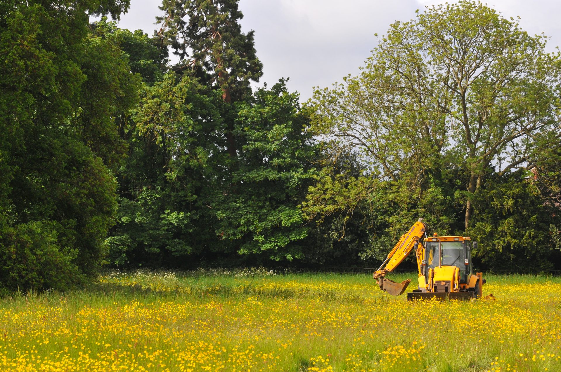
A digger poised to destroy historic grazing land at Thame. The site has been allocated for destruction and development in the town’s neighbourhood plan. Photo: Richard Jeffries
• The Wing neighbourhood plan (Aylesbury Vale District, Bucks) has highlighted the unclear definition of ‘close proximity’ and ‘extensive tract of land’ in the criteria for LGS, putting open spaces under threat.
• The Backwell neighbourhood plan (North Somerset): the developers instructed barristers to object to designation of land as LGS. At the examination hearing the examiner proposed deletion of these policies and the land will not now be protected.
• The North Dorset neighbourhood plan (North Dorset District, Dorset): the LGS designation is merely being used to secure land which is already protected, not to save threatened open spaces.