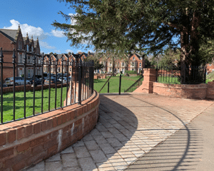
Do you have an open space which needs protecting? Here are some mechanisms to help you take action to protect open space in communities in England and Wales.
We will now look at neighbourhood planning and the way in which it can be used to help protect valued open spaces in England.
Next, we will look at Local Green Space designation and the way it can be used to protect local green areas in England.
What is local green space designation?
The National Planning Framework (NPPF), published by the Ministry of Housing, Communities & Local Government in July 2018, and with minor amendments in February 2019, and further amendments in December 2023 and December 2024 sets out the government’s planning policies for England.
Paragraphs 106 to 108 introduce a Local Green Space designation (LGS) to protect local green areas of particular importance to local communities. This will enable communities, in certain circumstances, to identify and protect areas that are of value to them through local and neighbourhood plans.
Once designated, the LGS is subject to the same strong development restrictions as Green Belt, and new development here is ruled out other than in special circumstances.
The LGS is designated by the planning authority (borough, district, metropolitan or other unitary authority). Local people need to lobby the authority to designate LGS, based on the criteria. We explain below what we know of the LGS: whether to designate land is a matter for local discretion.
Some areas may already be available for public access, other land could be considered for designation even if there is no public access. Designation does not confer any rights of access over what currently exists.
The concept of community assets ('assets of community value') was introduced in Part 5, Chapter 3 of the Localism Act 2011. Community assets are defined as buildings or other land which are mainly in actual use for the social, well-being or social interests of the local community.
Our information sheet on community assets tells you about how to make use of the community asset process to protect your local space.
In this section we will share some useful examples of successful and unsuccessful neighbourhood plans in England which you may find helpful.
Queen's Crescent Garden

Queen's Crescent Garden has been beautifully regenerated following its adoption as a local green space. Photo: exeterstjames.org
One of the first plans to be made in 2013 enabled the protection and re-generation of Queen’s Crescent Garden in Devon.
Since its adoption as a local green space, the garden has been beautifully regenerated. It now forms a much-needed heart of a vibrant and diverse community.
Other examples
- The Thame plan failed to protect land as a local green space and it is now vulnerable to development.
- The Felpham plan protects eight acres of local green space in the West Sussex seaside village.
- The Wing plan ensured that green space was at the heart of local development.
- The Uppingham plan allowed residents to improve community spirit and strengthen community services.
Unfortunately there are no additional protective measures in Wales unlike LGS, assets of community value , and neighbourhood planning as exist in England. The following may be helpful:
- Natural Resources Wales has a greenspace toolkit which helps local authorities plan and improve green space for local people and some councils have supplementary planning guidance.
- Carmarthenshire CC have supplementary planning guidance ( Leisure and Open Space) in respect of requirements for new developments in the local development plan.
- Caerphilly CBC sets out the council’s approach to the protection of open space. It supplements Policy CW7 Protection of Open Space in the Local Development Plan.
- Swansea Council is developing an open space strategy up to 2025.
While the Open Spaces Society has made every effort to ensure the information obtained in this factsheet is an accurate summary of the subject as at the date of publication, it is unable to accept liability for any misinterpretation of the law or any other error or omission in the advice in this paper.
© Open Spaces Society 2025
