Support us from £3/month
We deal with almost 1000 cases a year assisting communities, groups and individuals in protecting their local spaces and paths in all parts of England and Wales. Can you help us by joining as a member?
As Britain’s leading pressure-group for open spaces, we say that today’s launch of a new ‘comprehensive map of greenspaces’(1) fails to deliver the Government’s commitment to map ‘all open-access green space’.
The Ordnance Survey has announced the publication of a database of greenspaces in Great Britain. The database is offered via a mapping tool online, and freely available for download. The database responds to the commitment by the Conservative party in its 2015 manifesto to, ‘make it easier to access our beautiful landscapes, by providing free, comprehensive maps of all open-access green space.’
The database does not discriminate between public open spaces and land used exclusively for private recreation. Public and private golf courses are both shown as accessible greenspace, as are allotments, private school recreation grounds and private sports facilities such as bowling greens.
Speaking today, Hugh Craddock, one of our case officers, said: ‘We welcome progress towards making open space more visible, accessible and attractive to all. But the new greenspace data are more likely to confuse than clarify. The data will show a golf course on common land with a statutory right of access in the same way as an exclusive, private golf course — but the latter might be accessible only to members or on payment of a £150 green fee.’
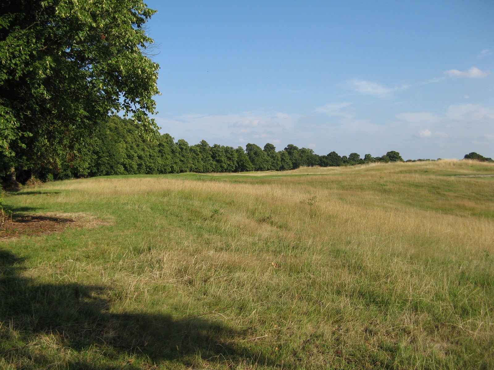
Buckinghamshire golf course at Denham Village: marked as greenspace but no public right of access.
‘Many other areas of greenspace are also inaccessible to the public—allotments, private school playing fields and private sports facilities — but these too are mapped with no indication of whether the public can use them, and if so, on what terms. This is not what the public will understand as ‘open-access greenspace’. Users of the new database risk being seriously misled, and owners of private facilities aggrieved, if the public rely on the data to identify open-access land.
‘Yet, ironically, the database ignores most of our truly open access greenspace — extensive areas of open country and common land to which there is a right of access under the Countryside and Rights of Way Act 2000(2). The Ordnance Survey and the project sponsor, the Department for Business, Energy & Industrial Strategy, should immediately commit to work with stakeholders to refine the data and publish a database of truly accessible land in Great Britain.
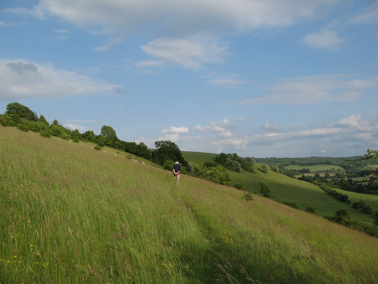
Cobstone Hill in the Buckinghamshire Chilterns, access land but not shown as greenspace on the OS map.
1 ‘New online maps to help Britons experience their local greenspaces’ (Ordnance Survey); Ordnance Survey has released a comprehensive map of greenspaces throughout Great Britain (Department for Business, Energy & Industrial Strategy).
2 There is a right of access to most ‘open country’ (mountain, moor, heath and down) and registered common land under Part I of the Countryside and Rights of Way Act 2000. Such land is not recorded on the database as greenspace unless it has been surveyed as a public park, golf course or one of the other sports and leisure facilities included in the greenspace definition.