Support us from £3/month
We deal with almost 1000 cases a year assisting communities, groups and individuals in protecting their local spaces and paths in all parts of England and Wales. Can you help us by joining as a member?
Chris Peat, our representative on Charnwood Forest Regional Park Steering Group, has sent us this report:
The Open Spaces Society strongly supports the development of the Charnwood Forest Regional Park because it will protect and enhance important open spaces within easy reach of the urban areas of Leicester and Loughborough at the eastern end of the National Forest.
Members of the OSS may be familiar with Charnwood Forest, which is a distinctive area of upland landscape to the north-west of Leicester. It is valued for its international geological importance, rich biodiversity, landscape beauty, historical importance, and recreational role. The area includes popular public open spaces, commons and country parks, and offers good walking and wide views. It is also a working landscape, bisected by the M1 motorway, home to several granite quarries, and with a high proportion of land in agricultural use.
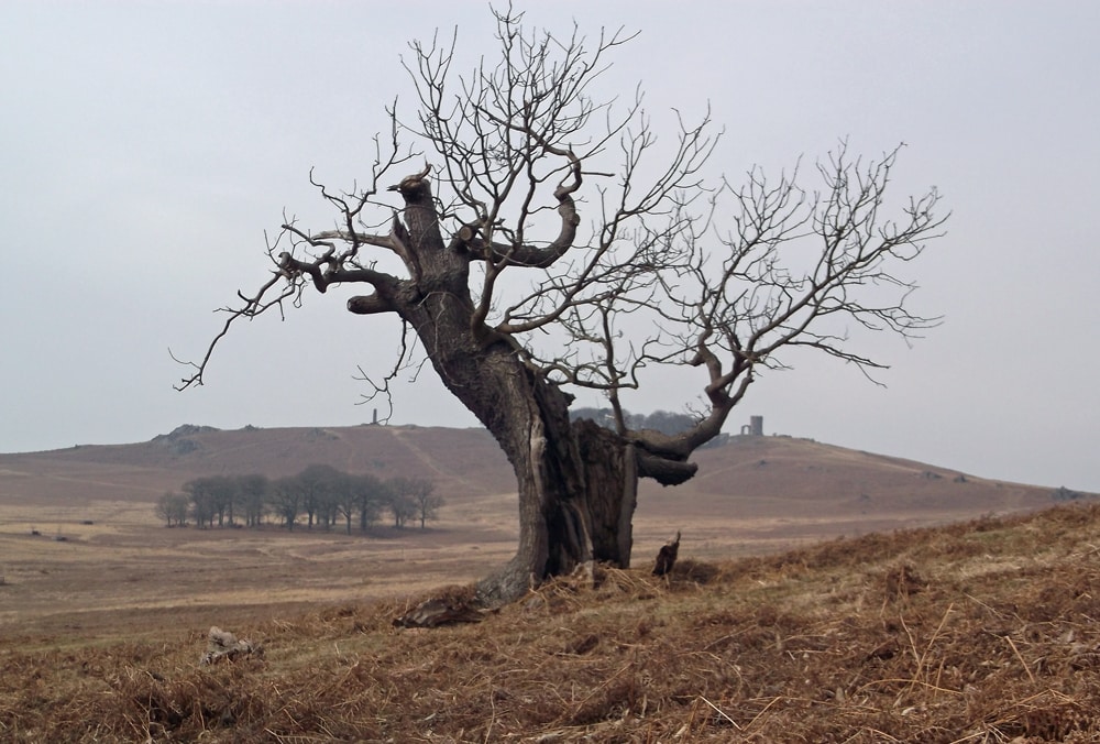
Ancient oak tree in Bradgate Park
The objectives of the Charnwood Forest Regional Park are
– to manage and promote landscape and settlement character, including biodiversity, geodiversity and cultural and industrial heritage features
– to promote sustainable leisure and tourism
– to support agricultural diversification and woodland and rural economy uses which respect local character.
The Regional Park is managed and directed by a Steering Group, which consults annually with a Stakeholder Group, on which the OSS is represented.
The Charnwood Forest Regional Park does not yet have a public profile or web presence, mainly because of ongoing cuts to local government budgets. However, the Friends of Charnwood Forest publish a regular newsletter, and there are many successful projects within the Park area with their own websites.
A recent bid for a Heritage Lottery Fund Landscape Partnership grant failed because the proposed scheme would not establish a strong identity for the area, and lacked an overarching vision and cohesiveness. These issues lay behind the discussions and working groups at a meeting of the Stakeholder Group on 26th November. The problem is that the Charnwood Forest area is very varied, and there is already a wide range of ongoing projects, many of which are run by voluntary groups with their own funding. It is very difficult to come up with a simple brand name which encompasses the range of attractions and experiences on offer.
Another problem is that there are few attractive walking routes leading from the surrounding urban areas into the Forest, which means that most walkers drive into the Forest and park there. Within the Forest, there are not many good circular walks of 3-5 miles in length, with the result that the majority of recreational visitors go to the honeypot sites, leading to crowds, disturbance and erosion. One of the objectives of the Regional Park is to create new linkages, spread visitors more widely, and reduce damage to the more sensitive sites. The National Forest is a key partner in this ongoing work and seeks to link existing sites and rights of way through new woods and access areas.
A Charnwood Forest Regional Park map is now available. This colourful, award winning 1:25,000 Ordnance Survey-based map covers the whole of the Regional Park on a single sheet, with additional information on permissive access and features of interest. It costs £4.99 (p+p £1.50) and can be purchased online here.
Click on the following links for further information about Charnwood Forest from the Friends of Charnwood Forest, or Charnwood Forest Regional Park for up-to-date information about the development of the park and meetings of the Steering and Stakeholder Groups.
Chris Peat
3rd December 2015